About AMAI's
Arabian Maps Aerial Imaging (AMAI) is a full-service Aerial Survey & Geospatial Solutions provider based in Riyadh, Saudi Arabia
It offers a spectrum of Customized Solutions to Public and Private sectors for various and multi-level projects and domains starting from small to large-scale projects such as infrastructure such as roads, power and water transmission lines, railways, bridges, dams, water reservoirs, airports, industrial complexes, oil and gas operations, and seawater desalination plants and complexes.
AMAI also offers its clients a full spectrum of Geospatial products, GIS applications, and database chains including consulting, data collection, processing, storage, and customized Software Solutions and services, and a host of software products.
By combining AMAI’s customized, cutting-edge Geospatial offerings with its in-house team of professionals,
AMAI is not only able to offer local support but is also able to tailor its offerings to cater exclusively to individual Geospatial requirements. Innovation, mobilization, integration, monitoring, and flexibility are the values that we stand for.
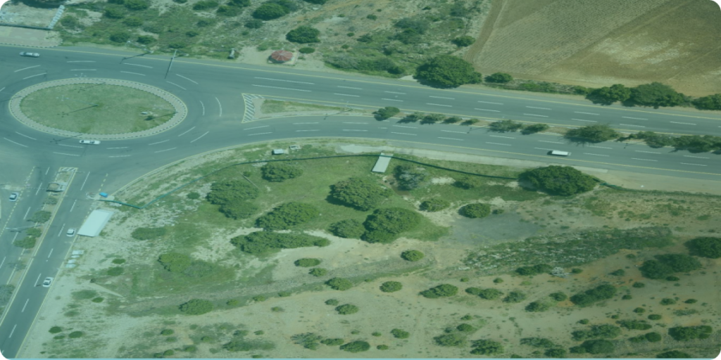
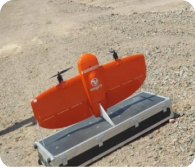
AMAI owns and operates several Vertical Take-off and Landing UAVs with high-resolution cameras (61MP) for aerial surveys.
These drones can offer from 1cm up to 30cm resolution imagery.
In AMAI, we rely on a highly qualified team with a core specialization in Aerial, terrestrial survey, 3D modeling on multiple levels, and mapping solutions to multi-level clients in the Kingdom of Saudi Arabia
CEO's speech
Ladies and Gentlemen,
Thank you all for visiting our website and you are welcome to all of you always,
At Arabian Maps Aerial Imaging Company, we are at the forefront of a technological revolution in the field of aerial surveying. Utilizing cutting-edge drone technology, we are transforming how data is collected, analyzed, and utilized in various industries. Our commitment to innovation and excellence has positioned us as leaders in this rapidly evolving sector.
Furthermore, AMAI’s drones are equipped with advanced sensors and imaging technologies that enable us to gather a wealth of information. Whether it’s the topographic data, details survey and mapping, monitoring crop health, inspecting infrastructure,
At AMAI, we are also deeply committed to sustainability. Our drone technology is always under improvement and development to be matched with the latest technologies in the world
As we look to the future, we are excited about the endless possibilities that lie ahead. Our team is continuously exploring new applications for our technology and pushing the boundaries of what drones can achieve. We are dedicated to staying at the cutting edge of innovation and delivering the highest quality services to our clients.
In closing, I would like to express my gratitude to our talented team at AMAI, whose hard work and dedication make our success possible. I also want to thank our clients and partners for their trust and collaboration. Together, we are shaping the future of aerial surveying, and I am confident that the best is yet to come.
Thank you once again. I look forward to continuing this journey of innovation and excellence with all of you.
Sincerely,
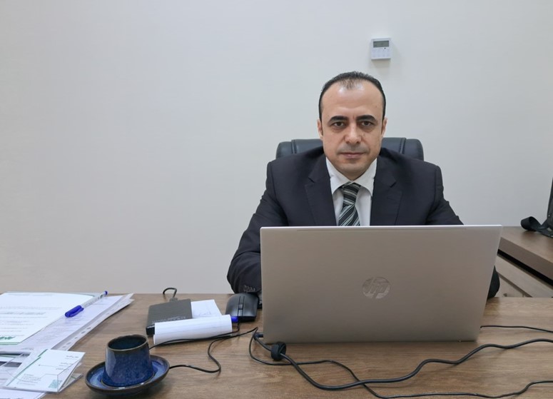
Sobhi Elsayed
CEO, Arabian Maps Aerial Imaging
AMAI has great Capabilities, learn about them now
Arabian Maps Aerial Imaging (AMAI) is a full-service Aerial Survey & Geospatial Solutions provider based in Riyadh,
- AMAI’s team has high capabilities and experience in data acquisition missions, processing, and production
- AMAI owns and operates several Vertical Takeoff and Landing UAVs equipped with high-resolution cameras (42 and 61MP) for aerial survey projects (Nadir and Oblique)
- AMAI has several workstations with high specifications and the required software for data processing and production
- AMAI’s team have high capabilities and experiences in data acquisition missions , processing and production
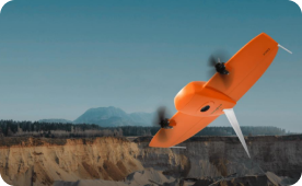

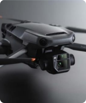
AMAI DRONES AND CAMERAS
AMAI has the latest technology in drones and cameras to be able to provide a highly professional service to our clients
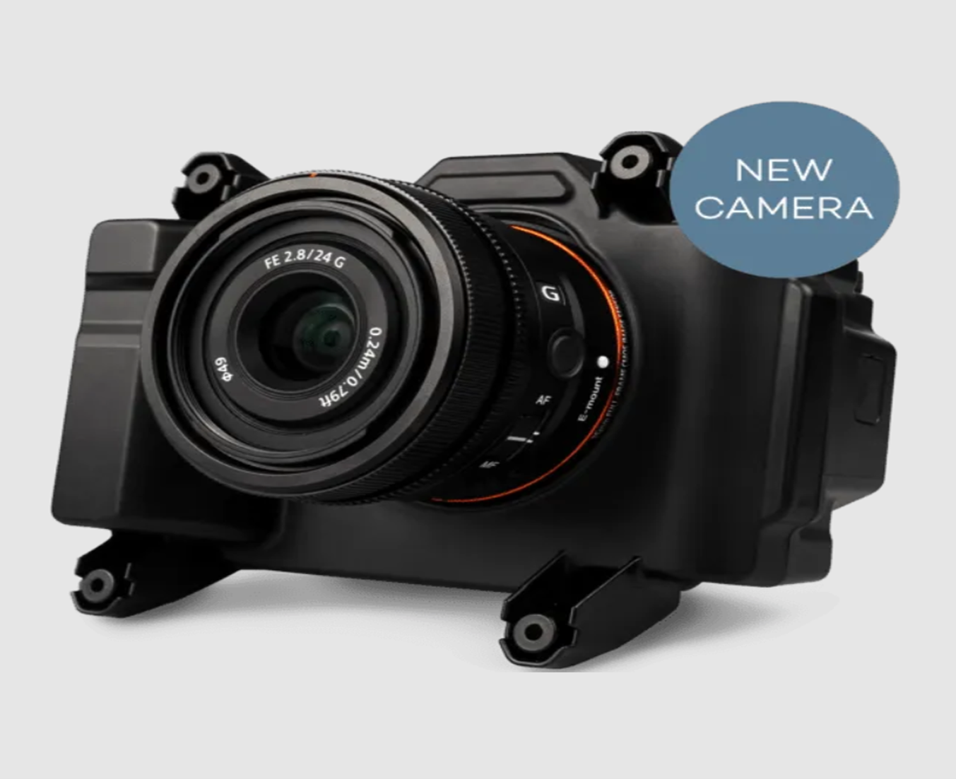
RGB61 - High-resolution mapping camera
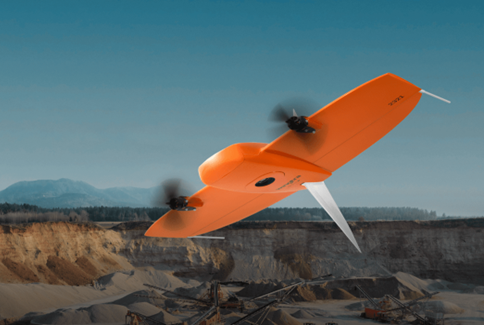
Wingtraone G2 with high capabilities for Oblique survey
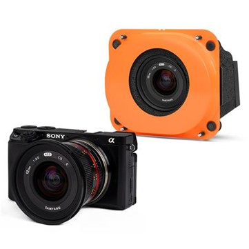
High-resolution Oblique Camera

DJI Mavic 3 pro
Our Mission
have all the necessary licenses , certificates and permits ( pilots and drones ) to conduct the drone survey projects certificates
Our Vision
have all the necessary licenses , certificates and permits ( pilots and drones ) to conduct the drone survey projects certificates
Our Taregt
have all the necessary licenses , certificates and permits ( pilots and drones ) to conduct the drone survey projects certificates

Ready to start your project
Get your project photographed by
experts and high technology
Arabian Maps Aerial Imaging (AMAI) is a full-service Aerial Survey & Geospatial Solutions provider based in Riyadh, KSA ,